Roads Less Traveled: Stanley Backroads
“Two roads diverged in a wood, and I—
I took the one less traveled by,
And that has made all the difference.” Robert Frost
There is something about a dirt road that is simply good for the sole. You can feel it the second the tires leave the pavement. An unleashing of a ridged conformed world. No more time for the anxieties of ordinary life weighing heavy on our hearts, there are adventures waiting down these dusty tracks.
My vacation plans, as well as my original topic for this blog, fell apart on me the last minute. I was planning on joining some friends on a 4-day backpack trip through the Sawtooths, but a foot injury, confusion and ultimately a cancelled trip, I was left to salvage what I could with my days off.
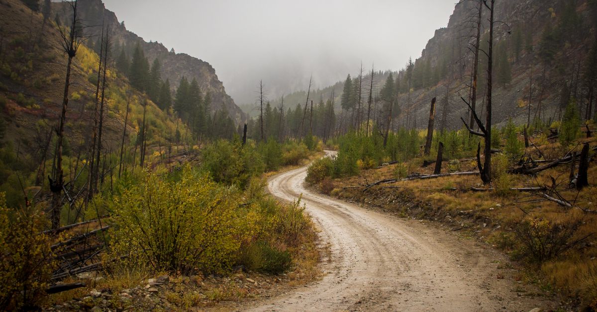
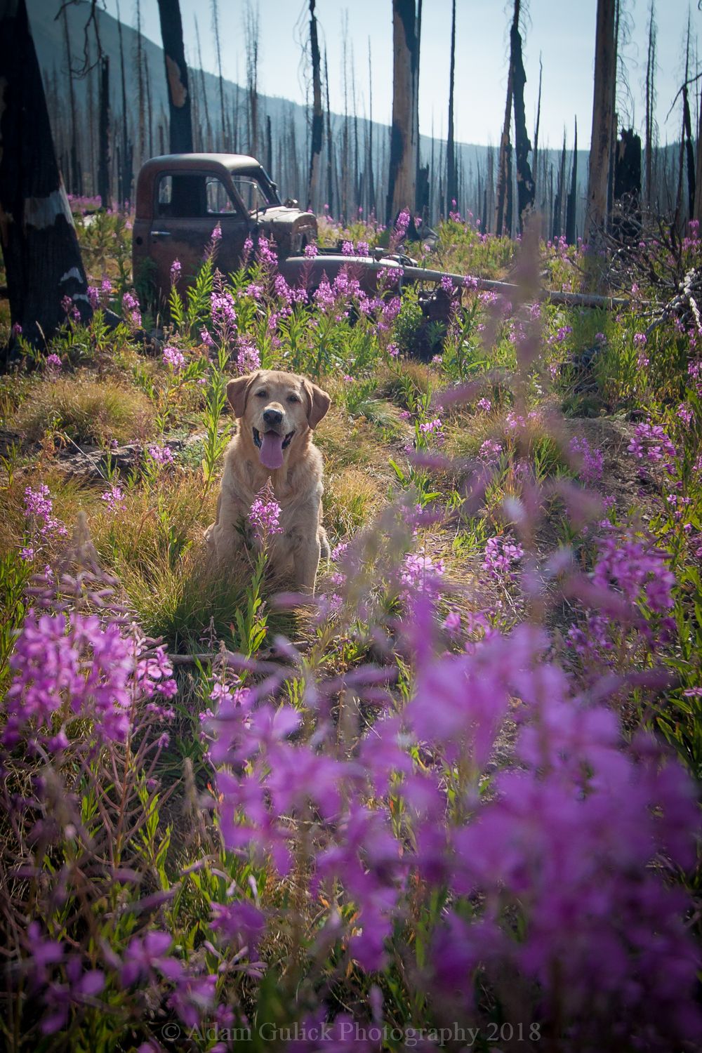
Stanley has its share of dirt roads. With a little help from Sawtooth Power Sports, a backup plan came into view. Me and my old yellow lab, Hunter, were about to embark on a 92-mile journey along the fringe of The Frank Church: River of No Return Wilderness. With my backpack already packed for spending the night in the mountains and the pupper dog loaded, I set off, dust flying up Nip n’ Tuck Road.
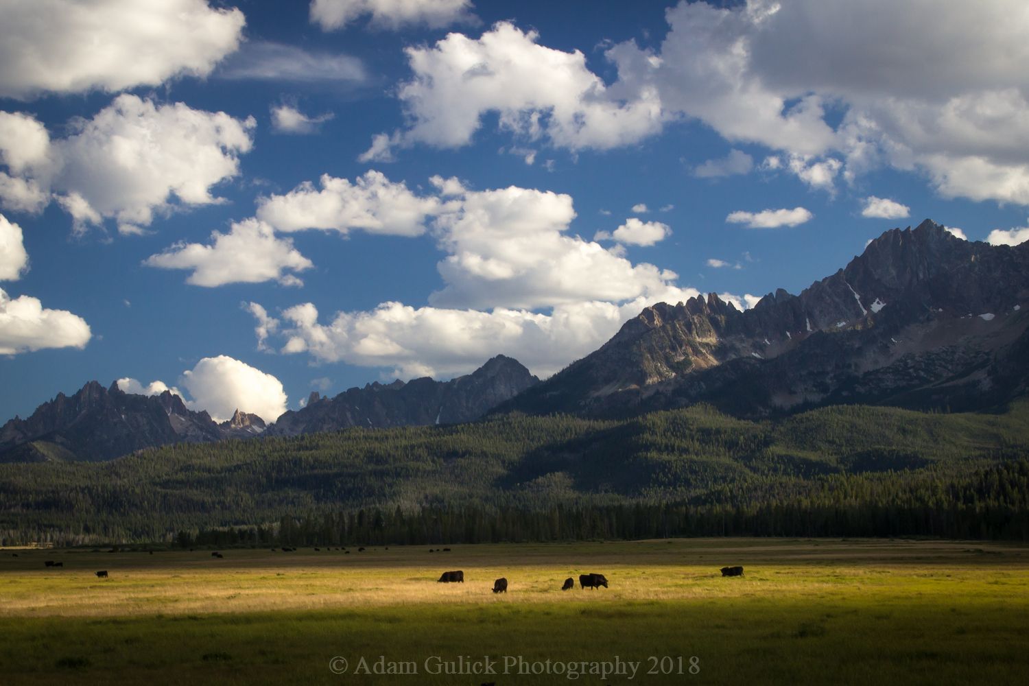
The first leg of the journey winds through the rolling sagebrush hills of Stanley Basin. The Sawtooth mountains dominating the southern skyline. In the spring and early summer painted in various shades of violet, from the camas, shooting star and elephants heads. Then the road heads westbound out cow camp road, along the meandering Valley Creek, and cattle grazing the pastures.
After crossing Valley Creek, the road takes you over Blind Summit where the water now drains toward the Middle Fork of the Salmon. From here, Cape Horn Road follows the headwaters of Marsh creek, though the expansive meadows where cranes nest, pronghorn roam, and Elk feed at the timbers edge. Roughly 20 miles into the journey, I arrived at Seafoam road where the route heads northeast, up beaver creek and into a landscape scared by fire. After about 4 miles you’ll reach a junction. Stay right on Beaver Creek road 172, which turns to Pinyon peak loop road as it begins to climb the Southface of Feltham Creek point. Both sides of the road are wilderness as you enter one of the few corridors into the largest wilderness in the lower 48. The scenery is now dominated by alpine meadows and granite slopes of the Salmon River Mountains. The road tops out as it saddles over into the top of trail creek. On the right, a side road leads to Feltham Creek Point where an impressive view opens across the central Idaho mountains. The road continues along the spine of a high ridge between the Loon Creek Drainage and the Rapid River. Only wide enough for one vehicle, this section of the journey will have your toes curling as the edge drops to the canyon below. This high line road follows the ridge above the mountain basins on its way to the highest point of the journey, Pinyon Peak (9942 ft.).
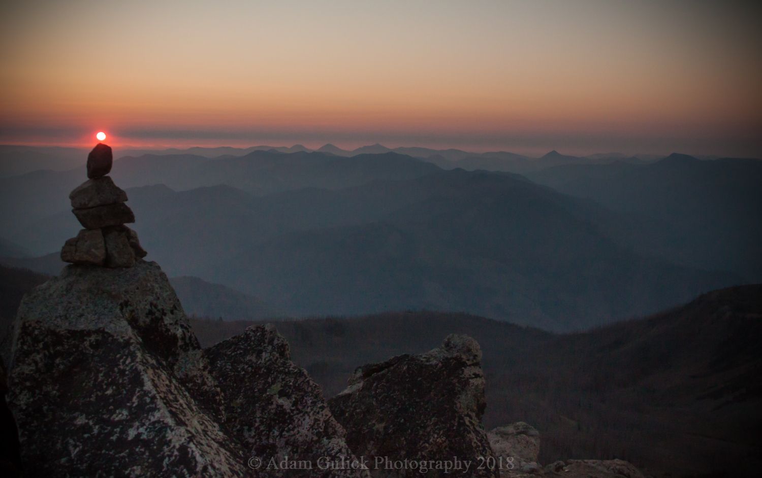
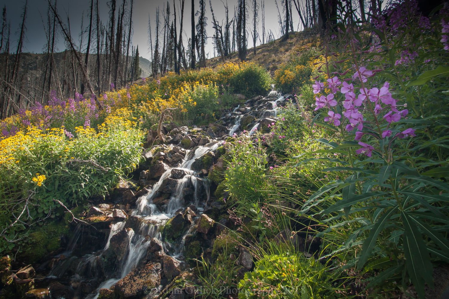
Atop Pinyon Peak sits a fire lookout, which seems reasonable given the expansive views in each direction, mountains fading into an endless sea. To the south some of the most rugged peaks in the wilderness reside. These red and white streaked peaks topple over 10,00 feet above numerous high mountain lakes. To the North, the canyons broaden and drops into the Middle fork of the Salmon. To the east Sheep Mountain and Greyhound Mountain stand guard over the Rapid River. At the bottom of the west flank of pinyon peak sits Diamond D Ranch and Loon Creek. 360 degrees of Idaho wilderness. Continuing on, the road drops off the Pinyon Peak into a Basin at the top of Canyon creek. The old burn and wet condition of the basin makes for an impressive wildflower display. The fireweed and Goldenweed were both in peak bloom while I was there.
The road continues down the canyon as the landscape morphs dropping into Loon Creek, one of the larger tributaries of the Middle fork. About 80 miles in Diamond D Ranch sits along Loon creek below the Jagged peaks which we’ve decended. The road departs from loon creek and follows Mayfield creek for 10 miles to the summit above Jordan Creek. All water now flows back into the Main Salmon. The journey is coming to an end as you drop down Jordan Creek into the Yankee Fork where old mining relics and ghost towns line the way. From here it's about 8 miles back to the highway at sunbeam dam and 13 miles upriver to Stanley.
Get away from it all on a Stanley backroad. The road less traveled is waiting your adventure!
You can find out more about local off-road rentals here!
Blog and Photography by Adam Gulick